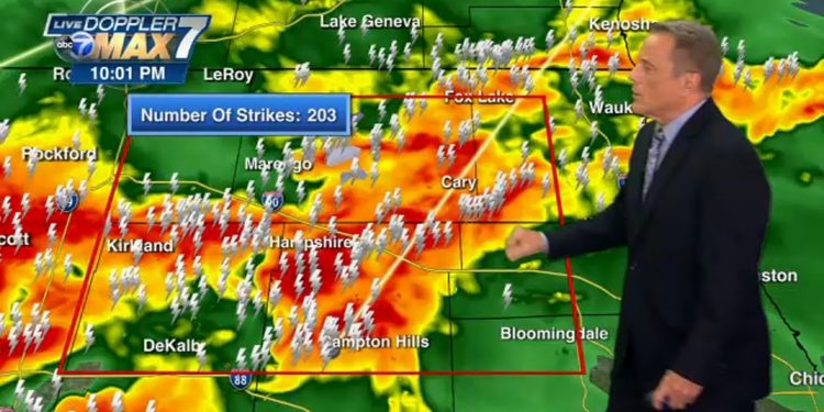
WLS-TV in CHICAGO reports: A line of severe storms that produced torrential rainfall and destructive winds across the Chicago area included a tornado that touched down in southern DuPage County on Sunday night. The tornado was part of the line of storms.
Both the Doppler radar and reports from local storm spotters indicated that a massive tornado was located in the southern part of DuPage County. On Monday, the National Weather Service is anticipated to verify both the storm’s intensity and its projected path.
As of 1:30 in the am on Monday, ComEd reports that more over 34,500 of their customers are without power.
Phil Schwarz, a meteorologist, expressed his belief that the tornado will likely be classified as an EF2 or higher, with winds exceeding 100 miles per hour. According to him, we are dealing with a “violent” storm that has caused major damage to both homes and trees.
The meteorologists at ABC7 estimate that the tornado lasted on the ground for twenty to thirty minutes, but it is important to note that the National Weather Service will evaluate the storm and its consequences in the following hours.
The radar-indicated and storm chaser-spotted wedge tornado touched down in DuPage County near the southern edge of Naperville for approximately 20 minutes. It then travelled approximately 10 to 15 miles west through Woodridge and Burr Ridge before weakening as it got to the area near Justice, Illinois, according to the meteorologists from ABC7.
There have been reports of damage and downed power lines in Woodridge, Darien, and the direction of Burr Ridge. Additionally, there have been reports of three individuals being injured in Naperville, and there have been claims of gas leaks.
A video captured in Woodridge showed considerable damage caused by the storm, including the complete uprooting of big trees. Roads and front yards were covered in debris, including shards of drywall and shingles from homes, as well as tree limbs and branches. Signs and electricity lines were both brought down in the incident. Woodridge also received assistance from rescue teams that came from the nearby communities of Lisle and Darien.
At approximately 12:30 in the morning, the police in Woodridge stated that they were in a position that required all available resources, but that there had been no reports of major injuries. They reported that the majority of the damage they have seen thus far has been to the structural integrity of homes and other buildings.
People are being asked by the police to remain inside and to keep away from places where emergency vehicles are working. This is especially important given to the increased risk provided by building damage, fallen trees, and downed power lines. It is currently unknown how long the power disruptions will last. In addition to that, there were reports of a few minor gas leaks.
Near the area of Interstate 55 in Burr Ridge, a ball of debris that was created by an unconfirmed tornado was observed on radar. This was a very rare occurrence.
Meteorologist Larry Mowry stated that it was the most powerful tornado that this region has seen in a long time. He also stated that the extent of the destruction is likely to be significant, particularly due to the wedge shape that the tornado took. Schwartz pointed out that although northeast Illinois has experienced a number of stronger tornadoes in recent years, they have occurred in much more rural areas with a lower population density than the area that is currently being affected by the storm.
Because of the extent of the devastation, it is impossible for emergency services to get to anyone who might require their assistance. While some first responders are attempting to make contact with anyone who might require assistance, others are working to clear the roadways so that people can pass through safely.
Even though the rotation in the line of severe storms continued to lessen as they travelled east, they still unleashed a torrent of rain and powerful winds that caused significant damage. Shortly after 12:30 in the morning, there were reports of some storm damage in Porter County, Indiana.
The torrential rain that fell in Chicago caused serious flooding around the city, and drivers had to negotiate through water that was six inches deep at the intersection of Interstate 55 and Kedzie in Brighton Park. The ground is hard and dry and less able to absorb rain as a result of the prolonged drought that has affected the entirety of the Chicago metropolitan area. This contributes to the conditions that lead to flash flooding.
At the time of 12:40 in the morning, the O’Hare International Airport had received about 2 inches of rain while the Midway International Airport had received nearly an inch.
Sunday afternoon in the Chicago region, a line of storms developed following a cold front that was moving in from the west. As a direct result of this tremendous tornado, the weather for the next few days is going to be very different from what it has been for the rest of June. Instead of hot and humid, it is going to be cool and comfortable.
It is anticipated that conditions will improve and dry out on Monday as the storms continue to move to the east. However, some winds are predicted to remain.
Storms greeted the start of the weekend.
Lightning, strong gusts, and heavy rain were brought to the Chicago area by storms that occurred overnight on Thursday and continued into Friday.
Around four in the morning on Friday, the storms began moving into Wisconsin from Illinois, and the lightning displays in Lake and McHenry counties were nothing short of spectacular. According to Butler, the storms continued to sweep over the region and had passed through Chicago by approximately 8:00 a.m.
At approximately 4:45 in the morning, a tree crashed into the middle of Sheridan Road in Evanston. Heavy rain also appeared to have made the roads slick and created standing water.
The rain will come as welcome relief, particularly to the northern suburbs. The drought conditions in Lake and McHenry counties have been described as “severe” recently and are the worst they’ve been since 2012.


