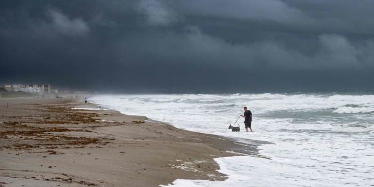
Hurricane Ian made landfall over the west coast of Florida as a category 4 storm on Wednesday afternoon, according to the National Hurricane Center.
The storm initially hit near Cayo Costa, Florida with maximum sustained winds at 150 mph, the center said on Twitter. It hit Punta Gorda, near Pirate Harbor, just a few hours later.
Hurricane Ian greatly intensified as it neared land, reaching winds of 155 mph and nearing the most dangerous Category 5 classification Wednesday morning. Hurricane force winds were 35 miles out from the center and tropical storm force winds were 150 miles from the center, according to the National Weather Service.
“This is going to be a nasty, nasty day, two days” Gov. Ron DeSantis said early Wednesday in a press conference. Officials in Florida and nationally are closely tracking the storm’s movements.
More than 2.5 million people were under mandatory evacuation orders in Florida, but legally, no residents can be forced to leave their homes. DeSantis said the highest-risk areas in the state range from Collier County up to Sarasota County, and it is no longer safe for residents in those counties to evacuate.
Zoom In IconArrows pointing outwards
“Do what you need to do to stay safe. If you are where that storm is approaching, you’re already in hazardous conditions. It’s going to get a lot worse very quickly. So please hunker down,” he said.
Rainfall near the storm’s landfall site could top more than 18 inches, and storm surges could push as much as 18 feet of water over nearly 100 miles of coastline, according to the National Hurricane Center. The National Weather Service has also issued the highest-possible wind warning for several regions in Florida in anticipation of extreme wind damage from the storm. But meteorologists were most concerned about the flooding.
“Water. We have to talk about the water,” warned National Weather Service Director Ken Graham. “90% of fatalities in these tropical systems comes from the water. It’s the storm surge, it’s the rain.”
Much of Florida’s west coast is already experiencing significant storm surges, as whipping winds and feet of water have blanketed the streets of cities like Fort Myers. The city wrote on Twitter that it is experiencing gusts of wind up to 77 mph and asked residents to “PLEASE stay indoors.” It warned that conditions will continue to escalate throughout the day.
Hurricane Ian approaches west coast of Florida on Sept. 28th, 2022.
NOAA
For residents who can still evacuate, American Red Cross CEO Gail McGovern encouraged them to follow the evacuation instructions of their elected officials and bring essential medication, documents and other items like glasses with them.
“Check on your neighbors and please don’t wait out the storm if you’re being told to evacuate — it’s dangerous,” she said in a Wednesday press briefing.
Gov. DeSantis said the state has 42,000 linemen, 7,000 National Guard troops from Florida and elsewhere and urban search and rescue teams ready to help when the storm is over.
A sail boat is beached at Sarasota Bay as Hurricane Ian approaches on September 28, 2022 in Sarasota, Florida.
Sean Rayford | Getty Images
More than 756,400 power outages have been reported across the state according to the Florida Division of Emergency Management, up from 200,000 outages Wednesday morning. DeSantis said the morning’s outages were just a “drop in the bucket” compared to the widespread power outages that are anticipated across southwest Florida over the next 48 hours.
The hurricane left all of Cuba without power after it pummeled the island on Tuesday, according to NBC News. At least two storm-related deaths were reported in Cuba as of Wednesday.
As the storm continues to batter the Florida coast, the National Hurricane Center issued new watches and warnings for parts of North Carolina and South Carolina.
Hurricane Ian is even visible from the International Space Station, with onboard cameras capturing footage of the storm as it looms over Florida.
The view of Hurricane Ian from cameras on the International Space Station, as the orbiting research laboratory passed near the storm around 3 p.m. ET on Sept. 28, 2022.
NASA TV
Even once the storm is over, DeSantis said it may not be completely safe to go outside. He encouraged residents to be careful of fallen powerlines, standing water and fallen trees.
President Joe Biden told Florida residents Wednesday he would support them through the storm “every step of the way.”
“We’ll be there to help you clean up and rebuild, to help Florida get moving again,” he said.
Utility trucks are staged in a rural lot in The Villages of Sumter County, Fla., Wednesday morning, Sept. 28, 2022, in preparation for Hurricane Ian.
Stephen M. Dowell/Orlando Sentinel via AP
Candy Powell, an east Orlando resident, has lived in Florida since 2016 and watched the state face hurricanes like Irma, Dorian and Matthew. She said she feels like there was less time to prepare for Hurricane Ian, but she is trying to stay calm for the sake of her neighbors.
“I think a lot of people who just moved into Florida were really, really stressed,” she told CNBC. “I’m kind of trying to be like the calming factor. Even going to the store yesterday, I actually just kind of had to almost get just regular groceries. The shelves were empty. There was hardly any canned stuff left.”
Powell can tell the storm is picking up, and she said she is already noticing rushing winds and heavy rain.
Flannery Dziedzic, who lives in Naples, said she has also noticed the winds pick up in her area. She said her power has been going in and out, and a piece of debris hit her window while she was on the phone with CNBC.
The storm seems bigger and more intense than hurricanes she’s dealt with in the past, she said, but since she is six miles from the coast, she feels “pretty safe.”
“I feel like Floridians are really resilient,” she said.
This story is developing, please check back for updates.
Source by www.cnbc.com


